The difference between El Niño and La Niña, and how to prepare

El nino and la nina
On this page

The difference between El Niño and La Niña, and how to prepare

El nino and la nina
Written
  • Preparedness

You may hear El Niño and La Niña mentioned in weather forecasts, but what do they mean for you?

Australia’s variable climate is shaped by large-scale patterns in the surrounding oceans and atmosphere. Some of these patterns are predictable and are known as climate drivers. One of the strongest is the El Niño–Southern Oscillation (ENSO).

ENSO is a natural cycle in the Pacific Ocean that influences weather around the world, including in Australia. It has 3 phases:

  1. El Niño
  2. Neutral
  3. La Niña.

Each ENSO phase affects Australia’s climate differently, with impacts that can extend beyond the long-range forecast period. A phase usually begins in the first half of the year and lasts until the following autumn. However, it can continue for 2 years or more. On average, the full cycle from El Niño to La Niña and back takes about 4 years. 
El Niño

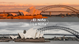
El Niño occurs when sea surface temperatures in the central and eastern Pacific Ocean are warmer than average. It typically occurs every 3 to 5 years.  

In Australia, El Niño is often associated with:

  • hotter temperatures
  • reduced rainfall across many areas
  • increased risk of drought
  • greater bushfire risk.

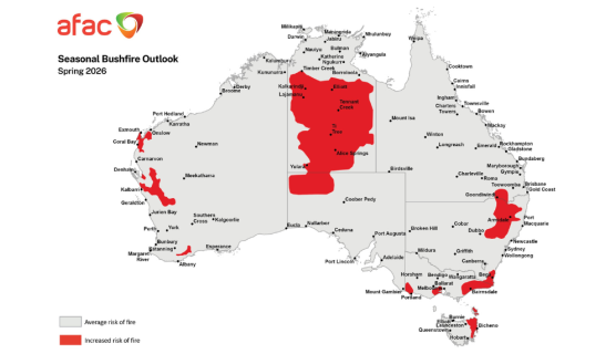
During El Niño, cooler waters around Australia and Indonesia reduce evaporation and rainfall. This can increase the risk of drought, heatwaves and bushfires in northeastern Australia. 

La Niña

La Niña occurs when sea surface temperatures in the central and eastern Pacific Ocean are cooler than average. It typically occurs every 3 to 7 years.

In Australia, La Niña is often associated with:

  • increased rainfall
  • cooler daytime temperatures
  • higher risk of flooding
  • more tropical cyclones and severe weather in some regions.

During La Niña, waters in the western Pacific are warmer. Stronger trade winds increase moisture in the air. This often brings more rain to eastern and central Australia. It can also lead to a wetter start to the northern wet season. 

How to prepare

El Niño and La Niña can influence the types of emergencies communities may face. They can also affect how communities need to prepare. El Niño brings hotter and drier conditions. This increase the risk of heatwaves, drought and bushfires. La Niña can bring wetter conditions. This increases the likelihood of floods, severe storms and tropical cyclones.

These hazards are more common during Australia’s Higher Risk Weather Season, from October to April. Communities should understand their local risks, monitor official warnings and keep their emergency plans up to date. 

Here are some practical steps everyone in your household can take to prepare for a disaster:

  • Plan your evacuation: Check local evacuation routes and choose a safe place to go.
  • Arrange a place to stay: Confirm accommodation with family or friends or identify your nearest evacuation centre.
  • Write down key contacts: List emergency services, neighbours, family, schools and vets.
  • Pack an emergency kit: Include food, water, medicines and a first aid kit. Add a torch, battery-operated radio, important documents, spare batteries and clothing.
  • Prepare for your pets: Decide where they will go and pack their food, medicines and other essentials.
  • Save your emergency radio frequency: Find your local ABC Radio frequency. Write it on your battery-operated radio and save it in your car radio.
  • Turn on alerts and check warnings: Follow the Bureau of Meteorology and enable notifications in your local emergency service apps. 

The National Resilience Action Library brings together practical resources and strategies. These can help homeowners reduce the impacts of disasters. Explore the library to learn how you can prepare for Higher Risk Weather Season.

For more information about El Niño and La Niña, visit the Bureau of Meteorology’s website.